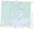
Maps showing Quarry Bay Channel, 3-65-28-W1, Manitoba
Quarry Bay Channel is a Channel located in 3-65-28-W1, Manitoba.
- Latitude: 54° 35' 55'' North (decimal: 54.5986000)
- Longitude: 101° 35' 48'' West (decimal: -101.5966999)
- Topography Feature Category: Channel
- Geographical Feature: Channel
- Canadian Province/Territory: Manitoba
- Location: 3-65-28-W1
- Atlas of Canada Locator Map: Quarry Bay Channel
- GPS Coordinate Locator Map: Quarry Bay Channel Lat/Long
Quarry Bay Channel NTS Map Sheets