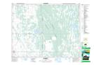
Maps showing Cutts, 34-20-15W, Manitoba
Cutts is a Unincorporated area located in 34-20-15W, Manitoba.
- Latitude: 50° 45' 22'' North (decimal: 50.7560999)
- Longitude: 99° 28' 48'' West (decimal: -99.4800000)
- Topography Feature Category: Unincorporated area
- Geographical Feature: Railway Point
- Canadian Province/Territory: Manitoba
- Location: 34-20-15W
- Atlas of Canada Locator Map: Cutts
- GPS Coordinate Locator Map: Cutts Lat/Long