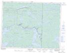
Maps showing Penzick Island, 24-17-16E, Manitoba
Penzick Island is a Island located in 24-17-16E, Manitoba.
- Latitude: 50° 26' 49'' North (decimal: 50.4468999)
- Longitude: 95° 15' 42'' West (decimal: -95.2616999)
- Topography Feature Category: Island
- Geographical Feature: Island
- Canadian Province/Territory: Manitoba
- Location: 24-17-16E
- Atlas of Canada Locator Map: Penzick Island
- GPS Coordinate Locator Map: Penzick Island Lat/Long
Penzick Island NTS Map Sheets