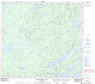
Maps showing Little Moose Point, 93-14W, Manitoba
Little Moose Point is a Cape located in 93-14W, Manitoba.
- Latitude: 57° 4' 39'' North (decimal: 57.0774999)
- Longitude: 99° 35' 30'' West (decimal: -99.5916999)
- Topography Feature Category: Cape
- Geographical Feature: Point
- Canadian Province/Territory: Manitoba
- Location: 93-14W
- Atlas of Canada Locator Map: Little Moose Point
- GPS Coordinate Locator Map: Little Moose Point Lat/Long
Little Moose Point NTS Map Sheets