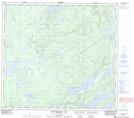
Maps showing Stillinger Lake, 93-14W, Manitoba
Stillinger Lake is a Lake located in 93-14W, Manitoba.
- Latitude: 57° 9' 19'' North (decimal: 57.1553000)
- Longitude: 99° 35' 11'' West (decimal: -99.5863999)
- Topography Feature Category: Lake
- Geographical Feature: Lake
- Canadian Province/Territory: Manitoba
- Location: 93-14W
- Atlas of Canada Locator Map: Stillinger Lake
- GPS Coordinate Locator Map: Stillinger Lake Lat/Long
Stillinger Lake NTS Map Sheets