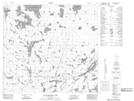
Maps showing Scott Point, 98-12W, Manitoba
Scott Point is a Cape located in 98-12W, Manitoba.
- Latitude: 57° 28' 25'' North (decimal: 57.4735999)
- Longitude: 99° 19' 44'' West (decimal: -99.3288999)
- Topography Feature Category: Cape
- Geographical Feature: Point
- Canadian Province/Territory: Manitoba
- Location: 98-12W
- Atlas of Canada Locator Map: Scott Point
- GPS Coordinate Locator Map: Scott Point Lat/Long
Scott Point NTS Map Sheets