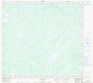
Maps showing Wilson Hill, 102-10W, Manitoba
Wilson Hill is a Mountain located in 102-10W, Manitoba.
- Latitude: 57° 51' 29'' North (decimal: 57.8580999)
- Longitude: 99° 5' 35'' West (decimal: -99.0930999)
- Topography Feature Category: Mountain
- Geographical Feature: Hill
- Canadian Province/Territory: Manitoba
- Location: 102-10W
- Atlas of Canada Locator Map: Wilson Hill
- GPS Coordinate Locator Map: Wilson Hill Lat/Long
Wilson Hill NTS Map Sheets