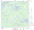
Maps showing Mundell Lake, 101-05W, Manitoba
Mundell Lake is a Lake located in 101-05W, Manitoba.
- Latitude: 57° 48' 4'' North (decimal: 57.8011000)
- Longitude: 98° 7' 27'' West (decimal: -98.1242000)
- Topography Feature Category: Lake
- Geographical Feature: Lake
- Canadian Province/Territory: Manitoba
- Location: 101-05W
- Atlas of Canada Locator Map: Mundell Lake
- GPS Coordinate Locator Map: Mundell Lake Lat/Long
Mundell Lake NTS Map Sheets