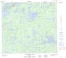
Maps showing Parry Lake, 104-04W, Manitoba
Parry Lake is a Lake located in 104-04W, Manitoba.
- Latitude: 57° 59' 40'' North (decimal: 57.9944000)
- Longitude: 98° 2' 55'' West (decimal: -98.0486000)
- Topography Feature Category: Lake
- Geographical Feature: Lake
- Canadian Province/Territory: Manitoba
- Location: 104-04W
- Atlas of Canada Locator Map: Parry Lake
- GPS Coordinate Locator Map: Parry Lake Lat/Long
Parry Lake NTS Map Sheets