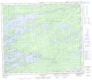
Maps showing McLeod Hill, 72-3E1, Manitoba
McLeod Hill is a Mountain located in 72-3E1, Manitoba.
- Latitude: 55° 13' 43'' North (decimal: 55.2285999)
- Longitude: 97° 3' 21'' West (decimal: -97.0557999)
- Topography Feature Category: Mountain
- Geographical Feature: Hill
- Canadian Province/Territory: Manitoba
- Location: 72-3E1
- Atlas of Canada Locator Map: McLeod Hill
- GPS Coordinate Locator Map: McLeod Hill Lat/Long
McLeod Hill NTS Map Sheets