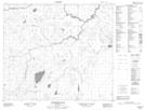
Maps showing William Smith Lake, 73-13W, Manitoba
William Smith Lake is a Lake located in 73-13W, Manitoba.
- Latitude: 55° 18' 41'' North (decimal: 55.3114000)
- Longitude: 99° 20' 11'' West (decimal: -99.3363999)
- Topography Feature Category: Lake
- Geographical Feature: Lake
- Canadian Province/Territory: Manitoba
- Location: 73-13W
- Atlas of Canada Locator Map: William Smith Lake
- GPS Coordinate Locator Map: William Smith Lake Lat/Long
William Smith Lake NTS Map Sheets