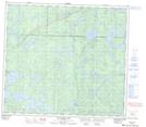
Maps showing Mitchell Peninsula, 87-25W, Manitoba
Mitchell Peninsula is a Cape located in 87-25W, Manitoba.
- Latitude: 56° 32' 11'' North (decimal: 56.5364000)
- Longitude: 101° 23' 41'' West (decimal: -101.3946999)
- Topography Feature Category: Cape
- Geographical Feature: Peninsula
- Canadian Province/Territory: Manitoba
- Location: 87-25W
- Atlas of Canada Locator Map: Mitchell Peninsula
- GPS Coordinate Locator Map: Mitchell Peninsula Lat/Long
Mitchell Peninsula NTS Map Sheets