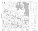
Maps showing Kelly Point, 117-8W, Manitoba
Kelly Point is a Cape located in 117-8W, Manitoba.
- Latitude: 59° 11' 9'' North (decimal: 59.1857999)
- Longitude: 98° 40' 30'' West (decimal: -98.6749999)
- Topography Feature Category: Cape
- Geographical Feature: Point
- Canadian Province/Territory: Manitoba
- Location: 117-8W
- Atlas of Canada Locator Map: Kelly Point
- GPS Coordinate Locator Map: Kelly Point Lat/Long
Kelly Point NTS Map Sheets