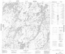
Maps showing Hughes Bay, 121-13W, Manitoba
Hughes Bay is a Bay located in 121-13W, Manitoba.
- Latitude: 59° 28' 37'' North (decimal: 59.4769000)
- Longitude: 99° 33' 00'' West (decimal: -99.5499999)
- Topography Feature Category: Bay
- Geographical Feature: Bay
- Canadian Province/Territory: Manitoba
- Location: 121-13W
- Atlas of Canada Locator Map: Hughes Bay
- GPS Coordinate Locator Map: Hughes Bay Lat/Long
Hughes Bay NTS Map Sheets