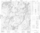
Maps showing Park Island, 121 - 15W, Manitoba
Park Island is a Island located in 121 - 15W, Manitoba.
- Latitude: 59° 28' 52'' North (decimal: 59.4811000)
- Longitude: 99° 55' 34'' West (decimal: -99.9261000)
- Topography Feature Category: Island
- Geographical Feature: Island
- Canadian Province/Territory: Manitoba
- Location: 121 - 15W
- GPS Coordinate Locator Map: Park Island Lat/Long
Park Island NTS Map Sheets