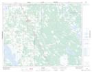
Maps showing McDougalls Marsh, Manitoba
McDougalls Marsh is a Low vegetation located in Manitoba.
- Latitude: 51° 7' 16'' North (decimal: 51.1210999)
- Longitude: 98° 1' 5'' West (decimal: -98.0180999)
- Topography Feature Category: Low vegetation
- Geographical Feature: Marsh
- Canadian Province/Territory: Manitoba
- Atlas of Canada Locator Map: McDougalls Marsh
- GPS Coordinate Locator Map: McDougalls Marsh Lat/Long
McDougalls Marsh NTS Map Sheets