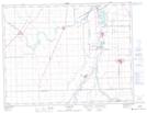
Maps showing Riel, Manitoba
Riel is a Village located in Manitoba and has an elevation of 236 meters.
- Latitude: 49° 48' 6'' North (decimal: 49.8017000)
- Longitude: 97° 5' 8'' West (decimal: -97.0856000)
- Topography Feature Category: Village
- Geographical Feature: Urban Community
- Canadian Province/Territory: Manitoba
- Elevation: 236 meters
- Atlas of Canada Locator Map: Riel
- GPS Coordinate Locator Map: Riel Lat/Long
Riel NTS Map Sheets