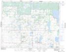
Maps showing Proven Lake Wildlife Management Area, 18-19W, Manitoba
Proven Lake Wildlife Management Area is a Conservation area located in 18-19W, Manitoba.
- Latitude: 50° 32' 25'' North (decimal: 50.5403000)
- Longitude: 99° 58' 37'' West (decimal: -99.9769000)
- Topography Feature Category: Conservation area
- Geographical Feature: Wildlife Management Area
- Canadian Province/Territory: Manitoba
- Location: 18-19W
- Atlas of Canada Locator Map: Proven Lake Wildlife Management Area
- GPS Coordinate Locator Map: Proven Lake Wildlife Management Area Lat/Long
Proven Lake Wildlife Management Area NTS Map Sheets