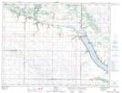
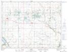
Maps showing Tiger Hills Wildlife Management Area, 32-05-16W, Manitoba
Tiger Hills Wildlife Management Area is a Conservation area located in 32-05-16W, Manitoba.
- Latitude: 49° 26' 12'' North (decimal: 49.4366999)
- Longitude: 99° 36' 5'' West (decimal: -99.6014000)
- Topography Feature Category: Conservation area
- Geographical Feature: Wildlife Management Area
- Canadian Province/Territory: Manitoba
- Location: 32-05-16W
- Atlas of Canada Locator Map: Tiger Hills Wildlife Management Area
- GPS Coordinate Locator Map: Tiger Hills Wildlife Management Area Lat/Long
Tiger Hills Wildlife Management Area NTS Map Sheets