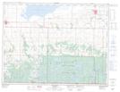
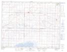
Maps showing Whitewater Lake Wildlife Management Area, 3-22W, Manitoba
Whitewater Lake Wildlife Management Area is a Conservation area located in 3-22W, Manitoba.
- Latitude: 49° 14' 36'' North (decimal: 49.2432999)
- Longitude: 100° 18' 45'' West (decimal: -100.3125000)
- Topography Feature Category: Conservation area
- Geographical Feature: Wildlife Management Area
- Canadian Province/Territory: Manitoba
- Location: 3-22W
- Atlas of Canada Locator Map: Whitewater Lake Wildlife Management Area
- GPS Coordinate Locator Map: Whitewater Lake Wildlife Management Area Lat/Long
Whitewater Lake Wildlife Management Area NTS Map Sheets