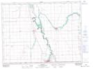
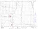
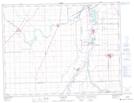
Maps showing Ste. Agathe, Manitoba
Ste. Agathe is a Geographical area located in Manitoba.
- Latitude: 49° 19' 5'' North (decimal: 49.3180999)
- Longitude: 97° 19' 30'' West (decimal: -97.3250000)
- Topography Feature Category: Geographical area
- Geographical Feature: Parish
- Canadian Province/Territory: Manitoba
- Atlas of Canada Locator Map: Ste. Agathe
- GPS Coordinate Locator Map: Ste. Agathe Lat/Long
Ste. Agathe NTS Map Sheets