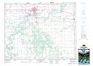
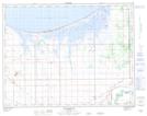
Maps showing High Bluff, Manitoba
High Bluff is a Geographical area located in Manitoba.
- Latitude: 49° 58' 25'' North (decimal: 49.9735999)
- Longitude: 98° 8' 55'' West (decimal: -98.1485999)
- Topography Feature Category: Geographical area
- Geographical Feature: Parish
- Canadian Province/Territory: Manitoba
- Atlas of Canada Locator Map: High Bluff
- GPS Coordinate Locator Map: High Bluff Lat/Long
High Bluff NTS Map Sheets