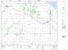
Maps showing Westbourne Settlement, Manitoba
Westbourne Settlement is a Geographical area located in Manitoba.
- Latitude: 50° 7' 35'' North (decimal: 50.1263999)
- Longitude: 98° 36' 15'' West (decimal: -98.6042000)
- Topography Feature Category: Geographical area
- Geographical Feature: Settlement
- Canadian Province/Territory: Manitoba
- Atlas of Canada Locator Map: Westbourne Settlement
- GPS Coordinate Locator Map: Westbourne Settlement Lat/Long