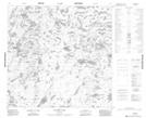
Maps showing Steele Island, 119-12W, Manitoba
Steele Island is a Island located in 119-12W, Manitoba.
- Latitude: 59° 22' 48'' North (decimal: 59.3799998)
- Longitude: 99° 25' 23'' West (decimal: -99.4230560)
- Topography Feature Category: Island
- Geographical Feature: Island
- Canadian Province/Territory: Manitoba
- Location: 119-12W
- Atlas of Canada Locator Map: Steele Island
- GPS Coordinate Locator Map: Steele Island Lat/Long
Steele Island NTS Map Sheets