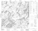
Maps showing Hunter Bay, 122-14W, Manitoba
Hunter Bay is a Bay located in 122-14W, Manitoba.
- Latitude: 59° 34' 28'' North (decimal: 59.5744000)
- Longitude: 99° 47' 3'' West (decimal: -99.7842000)
- Topography Feature Category: Bay
- Geographical Feature: Bay
- Canadian Province/Territory: Manitoba
- Location: 122-14W
- Atlas of Canada Locator Map: Hunter Bay
- GPS Coordinate Locator Map: Hunter Bay Lat/Long
Hunter Bay NTS Map Sheets