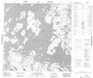
Maps showing McTavish Bay, 125-15W, Manitoba
McTavish Bay is a Bay located in 125-15W, Manitoba.
- Latitude: 59° 52' 58'' North (decimal: 59.8828000)
- Longitude: 99° 37' 5'' West (decimal: -99.6181000)
- Topography Feature Category: Bay
- Geographical Feature: Bay
- Canadian Province/Territory: Manitoba
- Location: 125-15W
- Atlas of Canada Locator Map: McTavish Bay
- GPS Coordinate Locator Map: McTavish Bay Lat/Long
McTavish Bay NTS Map Sheets