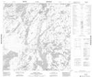
Maps showing Thomas Point, 124-11W, Manitoba
Thomas Point is a Cape located in 124-11W, Manitoba.
- Latitude: 59° 46' 48'' North (decimal: 59.7799999)
- Longitude: 99° 12' 31'' West (decimal: -99.2086000)
- Topography Feature Category: Cape
- Geographical Feature: Point
- Canadian Province/Territory: Manitoba
- Location: 124-11W
- Atlas of Canada Locator Map: Thomas Point
- GPS Coordinate Locator Map: Thomas Point Lat/Long
Thomas Point NTS Map Sheets