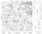
Maps showing Livingston Point, 126-4W, Manitoba
Livingston Point is a Cape located in 126-4W, Manitoba.
- Latitude: 59° 58' 51'' North (decimal: 59.9807999)
- Longitude: 98° 7' 36'' West (decimal: -98.1267000)
- Topography Feature Category: Cape
- Geographical Feature: Point
- Canadian Province/Territory: Manitoba
- Location: 126-4W
- Atlas of Canada Locator Map: Livingston Point
- GPS Coordinate Locator Map: Livingston Point Lat/Long
Livingston Point NTS Map Sheets