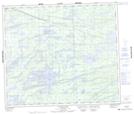
Maps showing MacDougall Island, 70-5E, Manitoba
MacDougall Island is a Island located in 70-5E, Manitoba.
- Latitude: 55° 3' 17'' North (decimal: 55.0547000)
- Longitude: 96° 50' 31'' West (decimal: -96.8419000)
- Topography Feature Category: Island
- Geographical Feature: Island
- Canadian Province/Territory: Manitoba
- Location: 70-5E
- Atlas of Canada Locator Map: MacDougall Island
- GPS Coordinate Locator Map: MacDougall Island Lat/Long
MacDougall Island NTS Map Sheets