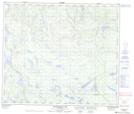
Maps showing Ross Hill, 72-18W, Manitoba
Ross Hill is a Mountain located in 72-18W, Manitoba.
- Latitude: 55° 12' 15'' North (decimal: 55.2042000)
- Longitude: 100° 11' 12'' West (decimal: -100.1866999)
- Topography Feature Category: Mountain
- Geographical Feature: Hill
- Canadian Province/Territory: Manitoba
- Location: 72-18W
- Atlas of Canada Locator Map: Ross Hill
- GPS Coordinate Locator Map: Ross Hill Lat/Long
Ross Hill NTS Map Sheets