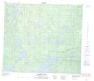
Maps showing Somerville Island, 72-25W, Manitoba
Somerville Island is a Island located in 72-25W, Manitoba.
- Latitude: 55° 16' 19'' North (decimal: 55.2719000)
- Longitude: 101° 13' 57'' West (decimal: -101.2324999)
- Topography Feature Category: Island
- Geographical Feature: Island
- Canadian Province/Territory: Manitoba
- Location: 72-25W
- Atlas of Canada Locator Map: Somerville Island
- GPS Coordinate Locator Map: Somerville Island Lat/Long
Somerville Island NTS Map Sheets