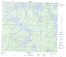
Maps showing Ireland Bay, 76-23W, Manitoba
Ireland Bay is a Bay located in 76-23W, Manitoba.
- Latitude: 55° 37' 24'' North (decimal: 55.6233000)
- Longitude: 100° 53' 7'' West (decimal: -100.8853000)
- Topography Feature Category: Bay
- Geographical Feature: Bay
- Canadian Province/Territory: Manitoba
- Location: 76-23W
- Atlas of Canada Locator Map: Ireland Bay
- GPS Coordinate Locator Map: Ireland Bay Lat/Long
Ireland Bay NTS Map Sheets