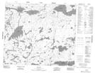
Maps showing Beatty Bay, 62-14E1, Manitoba
Beatty Bay is a Bay located in 62-14E1, Manitoba.
- Latitude: 54° 21' 44'' North (decimal: 54.3622000)
- Longitude: 95° 23' 33'' West (decimal: -95.3925000)
- Topography Feature Category: Bay
- Geographical Feature: Bay
- Canadian Province/Territory: Manitoba
- Location: 62-14E1
- Atlas of Canada Locator Map: Beatty Bay
- GPS Coordinate Locator Map: Beatty Bay Lat/Long
Beatty Bay NTS Map Sheets