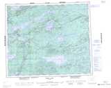
Maps showing O'Donnell Lake, 58-2E1, Manitoba
O'Donnell Lake is a Lake located in 58-2E1, Manitoba.
- Latitude: 54° 1' 3'' North (decimal: 54.0174999)
- Longitude: 97° 18' 8'' West (decimal: -97.3021999)
- Topography Feature Category: Lake
- Geographical Feature: Lake
- Canadian Province/Territory: Manitoba
- Location: 58-2E1
- Atlas of Canada Locator Map: O'Donnell Lake
- GPS Coordinate Locator Map: O'Donnell Lake Lat/Long
O'Donnell Lake NTS Map Sheets