Canada Topographic Maps

Rowe Bay Topo Maps

Topography maps and Latitude/Longitude Location

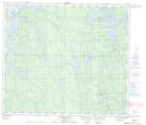
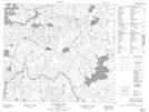
Maps showing Rowe Bay, 77-17W, Manitoba

Rowe Bay is a Bay located in 77-17W, Manitoba.

  • Latitude: 55° 42' 8'' North   (decimal: 55.7021999)
  • Longitude: 99° 57' 17'' West   (decimal: -99.9546999)
  • Topography Feature Category: Bay
  • Geographical Feature: Bay
  • Canadian Province/Territory: Manitoba
  • Location: 77-17W
  • Atlas of Canada Locator Map: Rowe Bay
  • GPS Coordinate Locator Map: Rowe Bay Lat/Long

Rowe Bay NTS Map Sheets

063N09 Pahayo Lake Topographic Map at 1:50,000 scale

063O12 Apeganau Lake Topographic Map at 1:50,000 scale

063N Kississing Lake Topographic Map at 1:250,000 scale

063O Nelson House Topographic Map at 1:250,000 scale

 
Buy Topographic Maps DVD
Newsletter Sign-up

Yes, I want to receive map store discounts.


Bookmark and Share