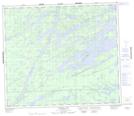
Maps showing Sidney Scott Island, 74-6E1, Manitoba
Sidney Scott Island is a Island located in 74-6E1, Manitoba.
- Latitude: 55° 23' 7'' North (decimal: 55.3852999)
- Longitude: 96° 36' 35'' West (decimal: -96.6096999)
- Topography Feature Category: Island
- Geographical Feature: Island
- Canadian Province/Territory: Manitoba
- Location: 74-6E1
- Atlas of Canada Locator Map: Sidney Scott Island
- GPS Coordinate Locator Map: Sidney Scott Island Lat/Long
Sidney Scott Island NTS Map Sheets