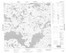
Maps showing McKay River, 114-3W, Manitoba
McKay River is a River located in 114-3W, Manitoba.
- Latitude: 58° 53' 45'' North (decimal: 58.8957999)
- Longitude: 97° 55' 10'' West (decimal: -97.9193999)
- Topography Feature Category: River
- Geographical Feature: River
- Canadian Province/Territory: Manitoba
- Location: 114-3W
- Atlas of Canada Locator Map: McKay River
- GPS Coordinate Locator Map: McKay River Lat/Long
McKay River NTS Map Sheets