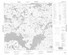
Maps showing Parkes Bay, 114-2W, Manitoba
Parkes Bay is a Bay located in 114-2W, Manitoba.
- Latitude: 58° 55' 21'' North (decimal: 58.9225000)
- Longitude: 97° 46' 42'' West (decimal: -97.7782999)
- Topography Feature Category: Bay
- Geographical Feature: Bay
- Canadian Province/Territory: Manitoba
- Location: 114-2W
- Atlas of Canada Locator Map: Parkes Bay
- GPS Coordinate Locator Map: Parkes Bay Lat/Long
Parkes Bay NTS Map Sheets