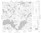
Maps showing William Johnston Lake, 115-2W, Manitoba
William Johnston Lake is a Lake located in 115-2W, Manitoba.
- Latitude: 58° 57' 13'' North (decimal: 58.9536000)
- Longitude: 97° 46' 52'' West (decimal: -97.7811000)
- Topography Feature Category: Lake
- Geographical Feature: Lake
- Canadian Province/Territory: Manitoba
- Location: 115-2W
- Atlas of Canada Locator Map: William Johnston Lake
- GPS Coordinate Locator Map: William Johnston Lake Lat/Long
William Johnston Lake NTS Map Sheets