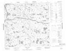
Maps showing Albert MacKay Lake, Manitoba
Albert MacKay Lake is a Lake located in Manitoba.
- Latitude: 58° 48' 18'' North (decimal: 58.8050000)
- Longitude: 97° 21' 10'' West (decimal: -97.3527999)
- Topography Feature Category: Lake
- Geographical Feature: Lake
- Canadian Province/Territory: Manitoba
- GPS Coordinate Locator Map: Albert MacKay Lake Lat/Long
Albert MacKay Lake NTS Map Sheets