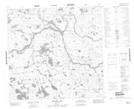
Maps showing Gilmour Island, 114-4E1, Manitoba
Gilmour Island is a Island located in 114-4E1, Manitoba.
- Latitude: 58° 52' 58'' North (decimal: 58.8827999)
- Longitude: 96° 55' 28'' West (decimal: -96.9243999)
- Topography Feature Category: Island
- Geographical Feature: Island
- Canadian Province/Territory: Manitoba
- Location: 114-4E1
- Atlas of Canada Locator Map: Gilmour Island
- GPS Coordinate Locator Map: Gilmour Island Lat/Long
Gilmour Island NTS Map Sheets