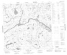
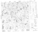
Maps showing Allen Creek, 114-8E1, Manitoba
Allen Creek is a River located in 114-8E1, Manitoba.
- Latitude: 58° 54' 45'' North (decimal: 58.9124999)
- Longitude: 96° 8' 20'' West (decimal: -96.1389000)
- Topography Feature Category: River
- Geographical Feature: Creek
- Canadian Province/Territory: Manitoba
- Location: 114-8E1
- Atlas of Canada Locator Map: Allen Creek
- GPS Coordinate Locator Map: Allen Creek Lat/Long
Allen Creek NTS Map Sheets