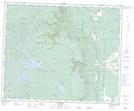
Maps showing Dyer Lake, 14-41-26W, Manitoba
Dyer Lake is a Lake located in 14-41-26W, Manitoba.
- Latitude: 52° 31' 52'' North (decimal: 52.5310999)
- Longitude: 101° 6' 18'' West (decimal: -101.1049999)
- Topography Feature Category: Lake
- Geographical Feature: Lake
- Canadian Province/Territory: Manitoba
- Location: 14-41-26W
- Atlas of Canada Locator Map: Dyer Lake
- GPS Coordinate Locator Map: Dyer Lake Lat/Long