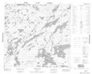
Maps showing Bradley Point, 111-13W, Manitoba
Bradley Point is a Cape located in 111-13W, Manitoba.
- Latitude: 58° 39' 26'' North (decimal: 58.6572000)
- Longitude: 99° 33' 22'' West (decimal: -99.5561000)
- Topography Feature Category: Cape
- Geographical Feature: Point
- Canadian Province/Territory: Manitoba
- Location: 111-13W
- Atlas of Canada Locator Map: Bradley Point
- GPS Coordinate Locator Map: Bradley Point Lat/Long
Bradley Point NTS Map Sheets