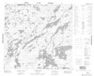
Maps showing Hough Island, 112-13W, Manitoba
Hough Island is a Island located in 112-13W, Manitoba.
- Latitude: 58° 44' 14'' North (decimal: 58.7372000)
- Longitude: 99° 36' 38'' West (decimal: -99.6106000)
- Topography Feature Category: Island
- Geographical Feature: Island
- Canadian Province/Territory: Manitoba
- Location: 112-13W
- Atlas of Canada Locator Map: Hough Island
- GPS Coordinate Locator Map: Hough Island Lat/Long
Hough Island NTS Map Sheets