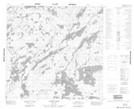
Maps showing Matthews Island, 110-14W, Manitoba
Matthews Island is a Island located in 110-14W, Manitoba.
- Latitude: 58° 32' 30'' North (decimal: 58.5416999)
- Longitude: 99° 39' 8'' West (decimal: -99.6521999)
- Topography Feature Category: Island
- Geographical Feature: Island
- Canadian Province/Territory: Manitoba
- Location: 110-14W
- Atlas of Canada Locator Map: Matthews Island
- GPS Coordinate Locator Map: Matthews Island Lat/Long
Matthews Island NTS Map Sheets