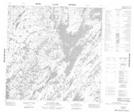
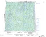
Maps showing Scaife Island, 125-19W, Manitoba
Scaife Island is a Island located in 125-19W, Manitoba.
- Latitude: 59° 53' 19'' North (decimal: 59.8886000)
- Longitude: 100° 39' 26'' West (decimal: -100.6572000)
- Topography Feature Category: Island
- Geographical Feature: Island
- Canadian Province/Territory: Manitoba
- Location: 125-19W
- Atlas of Canada Locator Map: Scaife Island
- GPS Coordinate Locator Map: Scaife Island Lat/Long
Scaife Island NTS Map Sheets