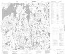
Maps showing Henry Robinson Lake, 120-2W, Manitoba
Henry Robinson Lake is a Lake located in 120-2W, Manitoba.
- Latitude: 59° 26' 3'' North (decimal: 59.4341999)
- Longitude: 97° 39' 29'' West (decimal: -97.6580999)
- Topography Feature Category: Lake
- Geographical Feature: Lake
- Canadian Province/Territory: Manitoba
- Location: 120-2W
- Atlas of Canada Locator Map: Henry Robinson Lake
- GPS Coordinate Locator Map: Henry Robinson Lake Lat/Long
Henry Robinson Lake NTS Map Sheets