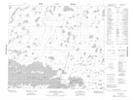
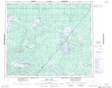
Maps showing Fuller Island, NE. of Gods Lake, Manitoba
Fuller Island is a Island located in NE. of Gods Lake, Manitoba.
- Latitude: 54° 45' 13'' North (decimal: 54.7535999)
- Longitude: 93° 58' 54'' West (decimal: -93.9817000)
- Topography Feature Category: Island
- Geographical Feature: Island
- Canadian Province/Territory: Manitoba
- Location: NE. of Gods Lake
- Atlas of Canada Locator Map: Fuller Island
- GPS Coordinate Locator Map: Fuller Island Lat/Long
Fuller Island NTS Map Sheets