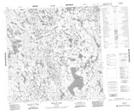
Maps showing Nicholls Point, 123-8E, Manitoba
Nicholls Point is a Cape located in 123-8E, Manitoba.
- Latitude: 59° 42' 1'' North (decimal: 59.7003000)
- Longitude: 96° 5' 44'' West (decimal: -96.0956000)
- Topography Feature Category: Cape
- Geographical Feature: Point
- Canadian Province/Territory: Manitoba
- Location: 123-8E
- Atlas of Canada Locator Map: Nicholls Point
- GPS Coordinate Locator Map: Nicholls Point Lat/Long
Nicholls Point NTS Map Sheets